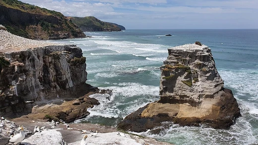
Cape Hatteras
Unincorporated community on Hatteras Island, North Carolina, historically known as Kinnakeet.

Avon is an unincorporated community and census-designated place (CDP) in Dare County, North Carolina, located on a narrow section of Hatteras Island. As of the 2020 census, it had a population of 832. The community is bordered by the Atlantic Ocean to the east and Pamlico Sound to the west, with North Carolina Highway 12 as its principal road, traversing approximately 3.4 miles within the CDP boundaries. Avon has a total area of 2.41 square miles, of which 2.36 square miles is land and 0.05 square miles is water.
- Location
- Hatteras Island, Outer Banks, North Carolina
- National Park designation
- Cape Hatteras National Seashore
- Known for
- Graveyard of the Atlantic
Verified Timeline
Lore & Background
Avon was historically known as Kinnakeet, a name that preserves the area's association with the island's Indigenous past. The Kinnakeet post office, established in 1873, was renamed Avon on March 22, 1883. Before European settlement, Hatteras Island was inhabited by Carolina Algonquian-speaking peoples, including the Croatoan or Hatteras Indians, with the Kinnakeet group associated with the area around present-day Avon. The waters off Kinnakeet formed part of the region known as the Graveyard of the Atlantic. One of the best-known local wrecks was the barkentine Ephraim Williams, which grounded on Diamond Shoals in December 1884; a seven-man crew from the Cape Hatteras station rescued all nine men aboard. During World War II, on January 19, 1942, the German submarine U-123 torpedoed the American passenger freighter City of Atlanta approximately 7 miles off Avon. The explosion was visible from the village, shook houses, and knocked objects from shelves; the ship sank with the loss of 44 of the 47 men aboard. Debris and oil washed onto the beach within hours. The Little Kinnakeet Life-Saving Station complex, located immediately north of Avon, was one of the first seven life-saving stations constructed along the North Carolina Outer Banks in 1874. It was restored by the National Park Service, and in 2024, the first regular public tours of its interior were offered as part of its 150th-anniversary observance.
Reader's Guide
Avon offers pedestrian access to the oceanfront via 22 public boardwalks located at the ends of its oceanside roads, originally installed during the 1980s and maintained by the Avon Property Owners Association. A replacement program began in 2025, with the first new boardwalks completed at Gulls Cry Road, Wahoo Circle, and Antillas Road. The National Park Service also maintains beach-access ramps at the northern and southern ends of the village: Ramp 34 has a pedestrian boardwalk and parking for 19 vehicles, providing year-round pedestrian access north of Avon; Ramp 38 provides year-round pedestrian and off-road-vehicle access south of Avon, with sandy pedestrian paths from its parking area. Seasonal vehicle access to the beach in front of Avon is available from both ramps, subject to National Park Service closures and permit requirements. Oceanfront property owners may own upland portions of their lots, including parts of the dunes, depending on the deed, but under North Carolina law, the seaward boundary generally ends at the mean high-water mark, with public-trust rights applying to the wet-sand beach and areas of dry sand occasionally flooded by tides. Land created above the mean high-water mark through publicly financed beach-nourishment projects is owned by the state and must remain open for public use. According to the 2020–2024 American Community Survey five-year estimates, Avon had a median age of 54.5 years, an estimated median household income of $35,365, and an estimated 1,555 housing units.
Did You Know?
- Avon was historically known as Kinnakeet; the Kinnakeet post office was renamed Avon on March 22, 1883.
- On January 19, 1942, the German submarine U-123 torpedoed the City of Atlanta approximately 7 miles off Avon, killing 44 of the 47 men aboard.
- The Little Kinnakeet Life-Saving Station, built in 1874, was one of the first seven life-saving stations on the North Carolina Outer Banks.
- Avon has 22 public boardwalks providing pedestrian access to the oceanfront, maintained by the Avon Property Owners Association.
- In December 2021, the 37-foot sailing vessel Alhambra grounded immediately north of Avon Fishing Pier and was refloated four days later.
A Narrow Slice Between Two Waters
Avon occupies a narrow slice of Hatteras Island, the Atlantic pressing against its eastern shore and Pamlico Sound lapping the west. The census-designated place spans just 2.41 square miles, buffered on both ends by Cape Hatteras National Seashore—roughly 11.5 miles of protected coast to Salvo in the north and 3.8 miles to Buxton in the south. North Carolina Highway 12 threads about 3.4 miles through the village. Beach access is a carefully negotiated balance. Private deeds may extend into the dunes, but state law caps seaward ownership at the mean high-water mark, leaving the wet-sand zone and tide-flooded dry sand under public-trust protection. Land added by state-funded nourishment belongs to the state and must remain open. Twenty-two boardwalks, first installed in the 1980s and maintained by the Avon Property Owners Association, give pedestrians a route to the water at the end of every oceanside street. A 2025 replacement program has already delivered new structures at Gulls Cry Road, Wahoo Circle, and Antillas Road. The National Park Service maintains two beach-access ramps at the village's northern and southern edges, with seasonal vehicle access subject to permits and closures.
The Name Kinnakeet and the People Before
Long before European settlement, the stretch of Hatteras Island now called Avon was home to Carolina Algonquian-speaking Indigenous communities. Historical geographer Gary S. Dunbar identified locally distinct groups—the Hatterask and the Kinnakeet—with the latter associated with the area around present-day Avon. These peoples depended on fishing, shellfish gathering, hunting, and locally cultivated crops. The Croatoan were encountered by English expeditions in the 1580s. Artist and cartographer John White, along with scientist Thomas Harriot, documented the villages, landscapes, and lifeways of the region's inhabitants. White's surviving paintings remain key visual records of Carolina Algonquian life before colonization and disease reshaped coastal communities. The name Kinnakeet endured as the local identifier for the settlement, though its original meaning remains uncertain and later sources have offered conflicting translations. It survives officially in Kinnakeet Township. The village's post office, established in 1873 under the Kinnakeet name, was renamed Avon on March 22, 1883. Archaeological work elsewhere on Hatteras Island, particularly near Buxton and Frisco, has uncovered Indigenous ceramics, shell deposits, and European objects attesting to contact between Native inhabitants and early settlers. No published evidence has established a sixteenth-century site within present Avon boundaries.
The Graveyard's Edge: Shipwrecks and Rescues
The waters off what was then called Kinnakeet formed part of the region long known as the Graveyard of the Atlantic. Sailing vessels waiting for favorable winds to round Cape Hatteras would gather offshore in large numbers; local accounts recalled as many as 150 ships tacking off Kinnakeet at a single time. A sudden shift in wind could drive those vessels onto the outer shoals or straight onto the beach. One of the best-known local wrecks was the barkentine Ephraim Williams. During a December 1884 storm the ship became waterlogged, drifted north, and grounded on Diamond Shoals opposite the Big Kinnakeet Life-Saving Station. A crew of seven from the Cape Hatteras station made it across several miles of heavy breakers in a surfboat, pulling all nine men from the water; the Big Kinnakeet crew assisted afterward. During an August 1899 hurricane, the schooner Robert W. Daley wrecked offshore near Little Kinnakeet, and surfmen from the Little Kinnakeet Life-Saving Station participated in the rescue. The same waters that drew ships to wait for fair winds also posed a constant, lethal threat, and the life-saving stations along the banks existed precisely because of it.
Torpedo Junction: War at the Village's Doorstep
Enemy submarine activity brought both world wars uncomfortably close to Hatteras Island. During World War II, the waters surrounding Cape Hatteras became known as "Torpedo Junction" because of the concentration of German U-boat attacks on merchant shipping. Shortly after 2 a.m. on January 19, 1942, the German submarine U-123 torpedoed the American passenger freighter City of Atlanta approximately seven miles off Avon. The explosion was visible from the village itself—a stark reminder that this small community sat squarely within the operational radius of a major naval theater. The "Torpedo Junction" designation reflected a broader pattern: the same stretch of ocean that had for centuries drawn sailing vessels to wait for favorable winds to round the cape had become a concentrated zone of enemy submarine activity. For the residents of Avon, the war was not a distant abstraction; it was a flash of light visible from their own streets in the dead of night. The wartime threat layered itself atop the region's long maritime history of storms, shoals, and shipwrecks, reinforcing the reality that the waters off Hatteras Island had always been as dangerous as they were beautiful.
Frequently Asked Questions
Who is Cape Hatteras?
Cape Hatteras is a prominent headland situated at a sharp bend along Hatteras Island, part of the Outer Banks chain in North Carolina. It juts out into the Atlantic where the island's arc curves back toward the mainland, forming a natural boundary between two large coastal basins.
What is Cape Hatteras's role in the ocean?
The cape marks the convergence point of the Gulf Stream and the Labrador Current, generating powerful, unpredictable offshore currents. These colliding water masses make the surrounding waters notoriously dangerous for navigation.
How does Cape Hatteras's maritime legacy unfold?
The offshore area near the cape has earned the nickname "Graveyard of the Atlantic" after more than six hundred vessels were wrecked there across roughly four centuries. The combination of shifting sandbars, fog, and conflicting currents made it one of the most lethal stretches of coastline in the Americas.
Why is Cape Hatteras important to visitors and conservation?
The cape anchors the Cape Hatteras National Seashore, a protected stretch of barrier-island habitat that shelters dunes, estuaries, and migratory bird corridors. It also hosts the Cape Hatteras Lighthouse, the tallest lighthouse structure in the United States at 198.48 feet.
What are Cape Hatteras's key geographic attributes?
The cape sits in a humid subtropical climate zone (Köppen Cfa) and receives over 61 inches of rain each year. The closest mainland landmass is Bermuda, roughly 563 nautical miles to the east-southeast, underscoring how far the Outer Banks extend into open ocean.
More in Coastal And Marine Features 1-24
Spotted an error? Know more?
This is a living reference — every entry is fact-audited, and reader corrections feed straight into our audit queue. Suggest an edit · See this site's audit record